Archive for the ‘Visualizing information’ Category

Portraying the vast flatland of the Playground – Part 1

Friday, July 17th, 2009

In “Escaping Flatland,” Edward Tufte describes the challenge faced by people who work in the field of visualizing complex information. These designers invent ingenious ways of portraying multi-dimensional data on the “flatlands of paper and video screens.”

My challenge in the first triptych of Playground of the Autocrats was the same, with a twist. I needed to find a way of depicting 3,500 miles of flat land within the dimensions of my 24″ x 48″ triptych.

Painting a single, particular view of the Russian steppes would not have been so problematic. Many artists have done it magnificently. But what I wanted to convey was that there are 3,500 miles of steppes, and that nowhere else on earth does such a vast open landscape exist. It was a lot of information to visualize in one relatively small artwork!

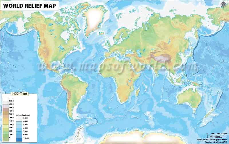
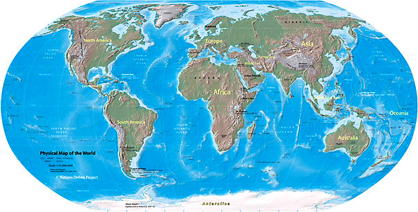
Maps, of course are one excellent way of conveying information about large areas of terrain. As you may have gathered from my last post, I love relief maps! I included a relief “globe” in my character design for Ivan the Terrible (one of Stalin’s fairy godfathers in Playground of the Autocrats). Ivan is on top of the world, dancing on his playground.

Ivan the Terrible on top of the world

Detail of triptych THE MOST EXPOSED TERRAIN ON EARTH: Ivan the Terrible on top of the world

I superimposed the caption “The Nomad Express: 3,500 open miles” across Russia. And I added arrows that marked the Mongol invasions across the vast open land.

Playground of the Autocrat's globe

Playground of the Autocrat's globe (Detail of THE MOST EXPOSED TERRAIN ON EARTH)

In addition, I wanted to layer in a more evocative portrayal of the vastness of Russia’s territory. Along with the map’s analytic information, I wanted to give the viewer a feeling of what it was to live in that wide-open, vulnerable landscape.

My animation script of Playground of the Autocrats had included a sequence of the Russian land as a reclining Mother Russia. As the lascivious godfather Ivan the Terrible conceived it, she was a peasant woman exposed to “rape by barbarian tribes.” Someday, when an animated version of Playground is realized, I think this will be a terrific sequence, as the terrain morphs into a 3,500-mile-long woman in Ivan’s imagination. But when I tried to create the image in a still form, it became too complex. Maybe I’ll tackle that route in another triptych.

Meanwhile, I had thought of another way of visualizing the endless Russian steppes. I drew on another centuries-old technique: many icons’ main images are surrounded by a frame of smaller images that convey additional information. Icons and religious art in general were the way Bible stories were communicated to illiterate populations. Hence, they are a wonderful model for how we can visualize information today. (The famous art historian Meyer Schapiro wrote a revered book about illustration of religious texts, called Words, Script, and Pictures: Semiotics of Visual Language.)

iconsbrdrs

Icons with borders of additional images

Russian folktale illustration, most notably perhaps the renowned Ivan Bilibin, followed in this tradition. Bilibin loaded up his borders with wonderful supplementary images that enhance the feeling of the central drawing, if not adding to the story. In the example on the right, the main illustration has a full-color border, while the surrounding text has a sepia-toned border with yet more fantastic, complex drawings.


Ivan Bilibin illustrations with borders of additional images

Ivan Bilibin illustrations with borders of additional images

In my next post, I’ll describe how I utilized the borders of “The Most Exposed Terrain on Earth” in this tradition. You can read that post here.

Landscape as Foundation: “The Most Exposed Terrain on Earth”

Wednesday, July 15th, 2009
Playground of the Autocrats Triptych 1:  The Most Exposed Terrain on Earth

Playground of the Autocrats Triptych 1: The Most Exposed Terrain on Earth . 24" x 48"

For an introduction to this topic, see What is Playground of the Autocrats?

I named my series of triptychs Playground of the Autocrats in part because a playground is typically flat. Sure, there are vertical structures built on it. But the ground itself is usually flat, providing unhindered opportunity to play.

The foundation of Russian society was literally its ground: the endless, flat Russian steppes. We often don’t give enough consideration to the ways in which different landscapes can shape the societies that live on them. We’re all aware that given natural resources are available only in particular geographic areas. Given crops can grow only in certain latitudes. Rivers facilitate travel. Coastlines and good harbors present opportunities that don’t exist for landlocked countries.

Beyond that, though, the very shape of the landscape can have a profound impact on how people live on it. We see this most easily in extreme landscapes. In the eons before motorized transportation, extremely rugged mountains often produced uncohesive social systems made up of very independent subunits. When it’s hard to get to the neighboring village because there are steep ravines and cliffs between you, there will be less communication and joint activity than if the intervening ground were flat.

Mountains also form barriers that protect against enemies. For most of human history – before we had motorized vehicles and airplanes – a high mountain chain made it very hard to get your army up and over to attack people on the other side. Even today, we see the impact of rugged terrain in Afghanistan: it has defeated many modern foreign armies that have sought to control it.

Throughout history, armies have chosen the highest points in the landscape for their forts and castles. Think the ubiquitous Italian hilltop castles. Think Masada. Think Dracula’s Bram Castle.

hilltopcastlesimages2

In the millenia before airplanes, the highest point in a landscape enabled inhabitants to see the approach of invaders from far off. The enemy would have a hard time trying to climb up a cliff to attack people ensconced above. Heights gave gravitational advantage to the residents whose arrows and hot oil could gather momentum falling downward, while the enemies’ arrows had to fight gravity on their way up.

At the other extreme, what about countries where the land is completely flat? What if you had no mountains forming a protective barrier around your country? What if there were no high cliffs to build your forts atop? In those cases, the inhabitants had to devote great energy and resources to coming up with other means of defense.

Of course there have been many castles and forts built all over the world on level ground when there was no other choice. This high-ground thing is a matter of degree, not absolutes. But in general terms, a vast, flat landscape was harder to defend than a mountainous one.

And if we look at relief maps of the world, we can easily see that Russia encompasses by far the largest flat expanse on earth: 3500 miles of open land.

In case you doubt this particular relief portrayal, here’s a different one:

And another:

Westerners often mistakenly think the Urals formed a barrier protecting European Russia. But in fact the Urals are for the most part low and easily-traversed. In addition, their southern end peters out in the open steppes: it’s easy to enter European Russia via the steppes at the southern end.

russiamapwispyurals

I believe that the openness of Russia’s terrain has had a profound impact on its development of a highly centralized state, beginning with the traumatic 13th century Mongol invasion and centuries-long occupation. I’ll talk more about the reasons why in another post.

Playground of the Autocrats

Friday, July 10th, 2009

plygrnd-autocrtshome-pgcaptions


Playground of the Autocrats is a series of triptychs that I’ve been quietly working on in my own time, behind the scenes, for the last 4 or 5 years. These mixed media triptychs are influenced by a combination of art animation and Russian history, icons, and folktale illustration. I consider them fine art, but until recently, I wasn’t sure whether anyone else would. However, one of the series, individually titled Home Security at Any Crazy Price, was selected by Nan Rosenthal for a political art exhibit she curated in early 2009, Contemporary Confrontations, at the Katonah Art Museum in Westchester County, just north of New York City. The New York Times review of the show referred to my “Home Security” as an “homage to Joseph Cornell…filled with wonderful goodies.” So I now have Rosenthal’s and the Times’ official stamp that this work is indeed fine art….

Playground of the Autocrats involves a degree of detail that is probably more obsessional than I would like to admit. Each triptych has taken a good two years or so to complete. This is partly because they contain so many figures and other details, each of which is intensively researched. For example, as my models for the peasants I painted in Home Security’s center panel, I used photos of actual 19th century Russian peasants that I found via a lot of searching on the internet and in my old Russian history books. The military figures I painted are based on popular books on Russian military history, whose illustrations have in turn been researched by the authors and artists.

"Home Security At Any Crazy Price," by Anne Bobroff-Hajal . 36" x 40" . Acrylic and digital images on canvas and board . 2009

As for the Playground of the Autocrats characters (Peter the Great, Ivan the Terrible, and next Catherine the Great) who appear in each triptych, I carefully designed and collaged them together from odds and ends reflecting their true historical actions and times. I’ve endlessly worked over each verse of the lyrics they sing with the aid of my beloved Rhyming Dictionary by Rosalind Fergusson (the only rhyming dictionary organized to work the same way my brain does).

Why do all this? one might ask. Sometimes I wonder myself. But the answer is that this is simply who I am as an artist.

Still, preparing to launch this thread, I started searching around the internet trying to figure out which blogging category Playground of the Autocrats fits into best. Is what I’m doing conceptual art? Is it political art? But my goal isn’t to push a particular political agenda. I’m mainly interested in visualizing my ideas about social systems, Russia’s in particular, in a fun, whimsical, and moving way (I’ll make you laugh, I’ll make you cry).

So maybe what I do is more akin to political cartoons? But my highly detailed work, designed to be gazed at for a long time, is different from political cartoons’ brilliant, quickly-readable commentary on single contemporary events. My work is about historical developments over the very long haul – centuries, not days. While I adore clever political cartoons, that’s not really what I’m doing.

Maybe I do something closer to comics or graphic novels? But I don’t have any page-turning! And my work – though it’s quirky and (I hope) humorous – is more academically-minded. So am I into something like information visualization? Hmmm. While I’m captivated by the likes of Edward Tufte, I’m creating art, not social science. Above all, my goal is to evoke emotional and esthetic responses as well as thinking ones.

In short, I don’t seem to fit into any single art or blog category. But I sure touch on a lot of them, many of which I find enthralling. I will refer to all in posts to come.